From Omar's notebook
In the book The Image of the City, they asked people to draw a map of their city and compared it with the real map. The goal was to uncover the "mental map" we form in our heads of the places we live.
I thought this sounded really fun, and I wanted to try exploring my own mental map of where I live in Ithaca, NY.
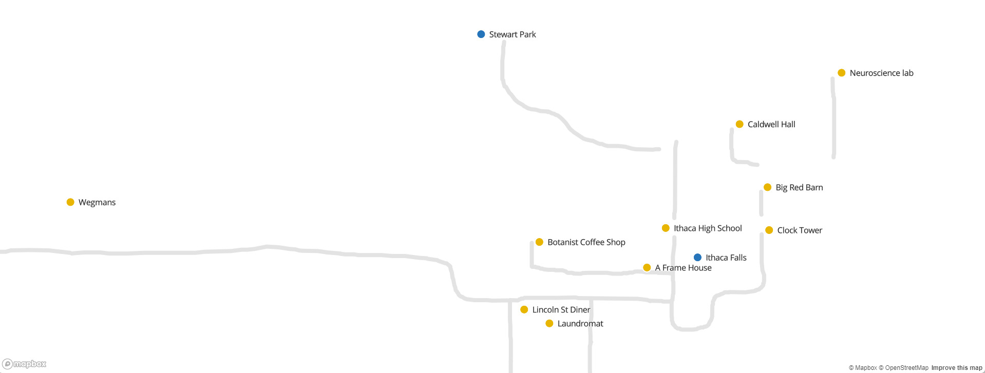
Below is what I came up with. I focused mainly on drawing areas I frequent, like coffee shops, where I get groceries, areas I like to walk etc.
I made this using Felt, so I could draw freely with the underlying map hidden, and then reveal it and super-impose my drawing on top.
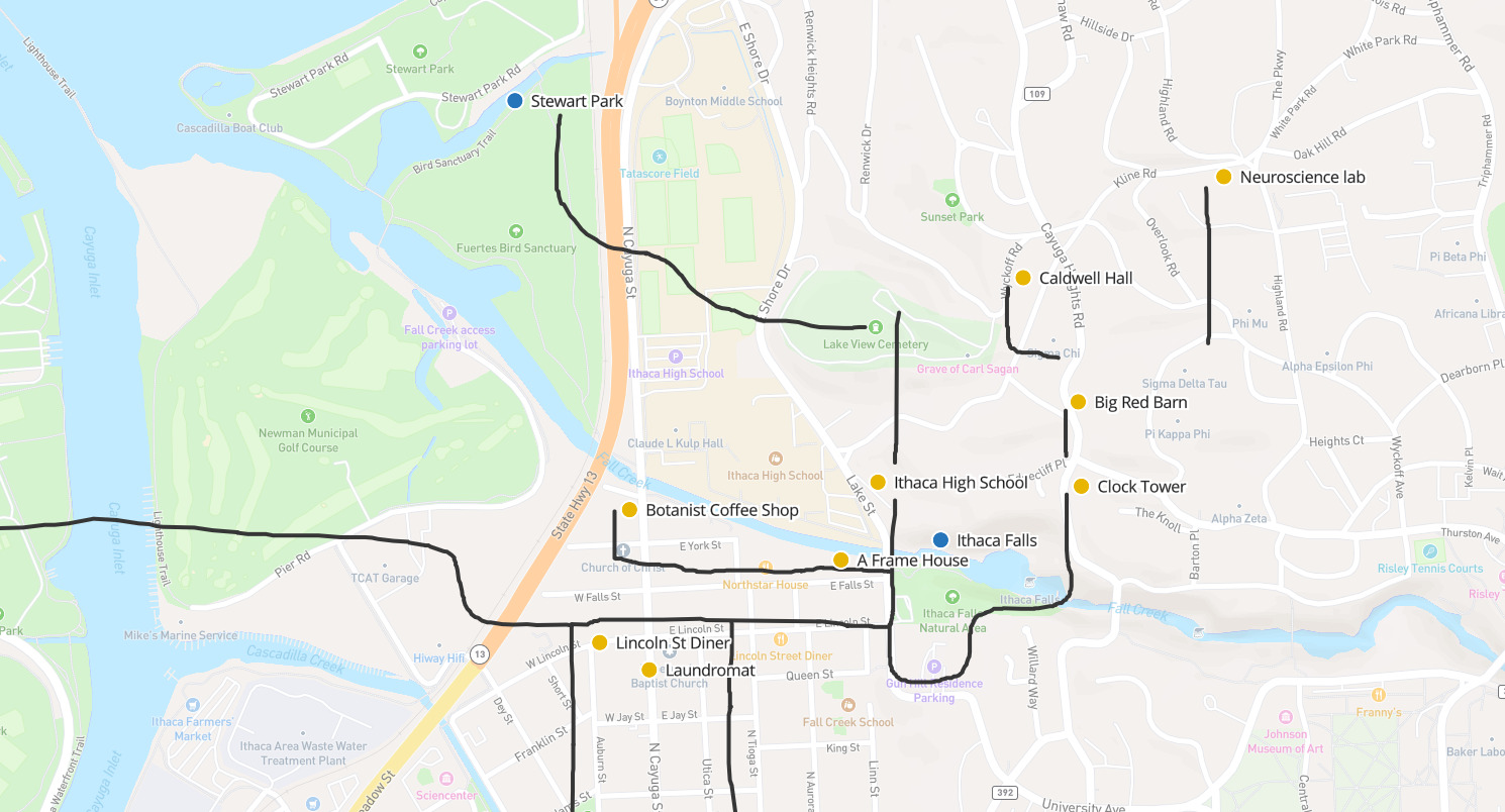
At first glance, it looks like I did pretty well! Stewart Park in the top left is roughly where it is, so is Ithaca High School, and Ithaca Falls.
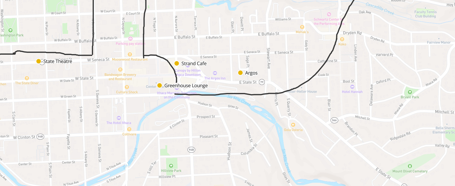
Looking at the downtown chunk of the map, I'm impressed how close I got Argos and Strand Cafe (which is inside "Canopy by Hilton").
But this is where you'll notice my bad sense of direction reveal itself: State Street, the black line that goes upwards in my map, goes south east in the real map. It's interesting to see that I got the relative positions and curve right, but just going in the wrong direction!
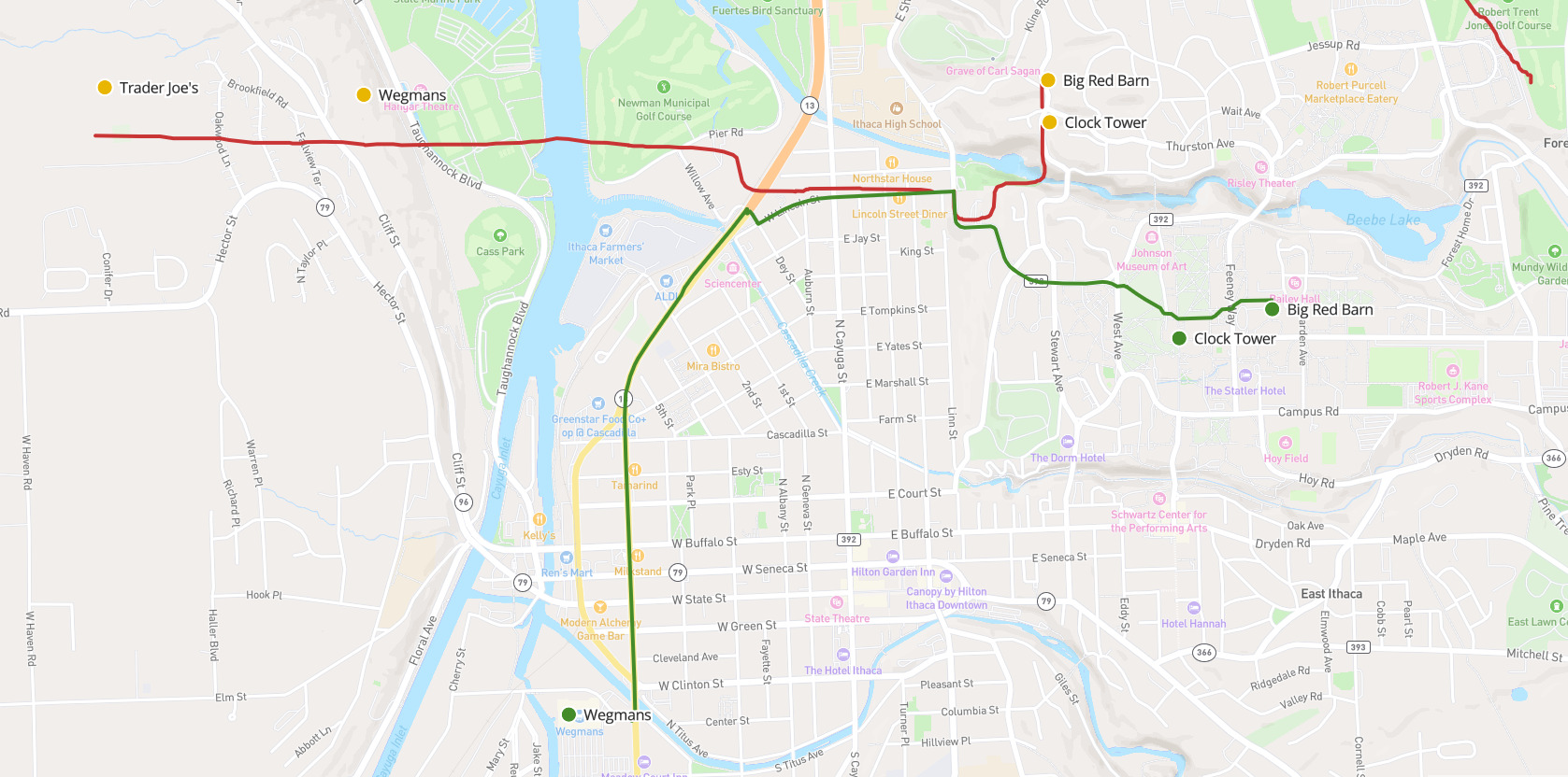
The biggest error I have in my map is that I got the directions of both the grocery stores (Wegmans) and landmarks on Cornell's campus (Clock Tower) completely wrong.
Below, I have the correct paths & landmarks in green.
This one was especially shocking to me because I walk up the Cornell hill to the clock tower almost every day!
I've always been bad at directions (that's the big joke with my friends: I work on maps for a living because I rely on this software so much!) But I've lived in Ithaca for a year and a half now, and I don't use the GPS to navigate here. This project has helped me realize that one reason I'm "bad" at directions is because of the type of map I create in my head.
I rely a lot on landmarks to navigate, and where they are relative to me (also called "egocentric navigation"). The road to Wegmans seems straight in my head because I just drive straight to it, following the road. I don't need to remember the ways the road twists to get there. In that way, the map in my head is more of a graph of nodes.
There's a couple of interesting consequences to this "graph of nodes" mental map:
I wrote up some instructions on how you can make & share your own mental map here:
https://github.com/OmarShehata/map-my-ithaca/blob/main/your-own-map.md
The instructions are specific to Ithaca but you can follow the same process to try it in your own city. I'd love to see people's mental maps, especially if others have similar interesting warped spaces in their heads. I think it's fun to see even if the map is fully accurate, because each of us will pick a different set of things we choose to plot.
It's kind of a personal, intimate thing when you think about it, getting to glance at someone else's personal map.